No.1
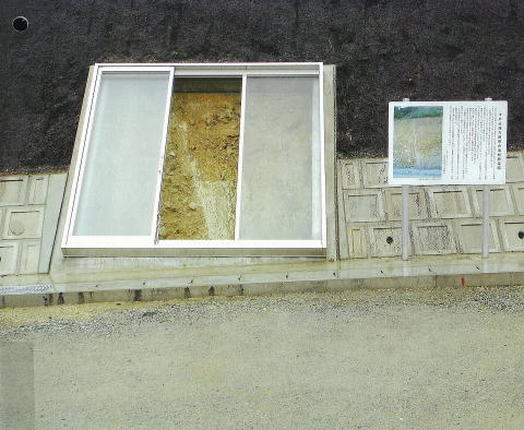
The photograph shows a showcase to preserve an active fault exposed on
a cut slope.
This showcase is to preserve a part of an outcrop of the active fault appeared
during the prefectural road improvement work at Shinomenakagou, Ato-town,Yamaguchi
prefecture.It was installed in December 2005 by the procurer of the work,
Yamaguchi prefecture Ato civil engineering office.The showcase preserves
the fault in the area of 3m×3m.The showcase is designed to have three tempered
glass doors that can move from side to side.The white gouge can clearly
be observed to show the bedrock and sediment layer are in fault contact.The
photograph of the fault taken before the cut slope was covered by protection
layer is shown on the front cover of Journal of JSEG,vol.46,No.6(Feb.2006).
(Photographed by Tatsuya MORIOKA)
No.2
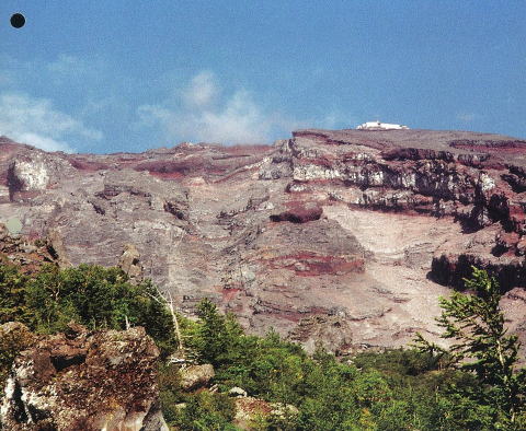
Osawa Collapse of Mt. Fuji
No.3
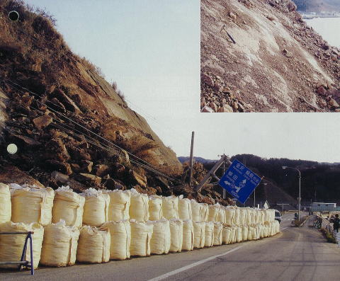
Rock mass failure caused by 2007 Noto Peninsula Earthquake
No.4
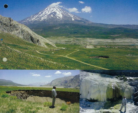
Mt. Damavand (EL. 5,610 m), the highest peak of Iran in the Alborz Mountain
Range as much as 3000 meters high, is an impressive stratovolcano during
the Quaternary (Picture at the top of the page). Lar Dam, a fill type dam,
was constructed in foot of Mt Damavand in 1981 for the purpose of water
supply for Teheran, the capital of Iran. However, water level of the reservoir
is still below the intake facility because of remarkable water seepage
from the dam reservoir. Andesitic lava of Damavand volcano covers the left
bank of the dam site. The Jurassic to Cretaceous limestone is distributed
from the reservoir area to the downstream of the dam site. Linearly-aligned
old and new limestone sinkholes, maximum hole 20 m- 30 m in diameter, are
found along the coast of the dam reservoir (Picture on the bottom-left
corner). A large travertine deposit crops out in the Lar valley at the
downstream of the dam site (Picture on the bottom-right corner). These
limestone sinkholes might be created by erosion due to hot water infiltration
through faults, and possibly cause the said water seepage from the dam
reservoir.
(Photographed by Shuichi Hasegawa)
No.5
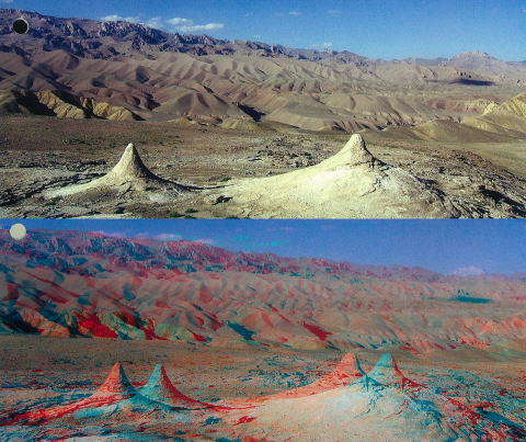
The picture at the top of the page presents an unusual landscape of carbonate
chimneys at Dragon valley approximately seven kilometers to the west of
Buddhist monuments at Bamiyan. The carbonate chimney grows upward in the
direction opposite to stalactite, and forms a semi-logarithmic-curved surface
shape. A river course behind the chimneys in this picture was changed its
direction by continuous blowout of carbonate minerals from these chimneys.
This is one of the few cases in land-forming process except for erosion.
The picture at the bottom of the page is an anaglyph-image of the carbonate
chimneys, which provides a stereoscopic effect of views, when viewed with
two different color (red and cyan) glasses. Thanks to advancement in computer
image processing technique, color photo-editing tool for a stereo effect
image has been developed in addition to monochrome sstereoscopic imaging
familiar to us.
(Photographed by Kaoru Shima)
No.6
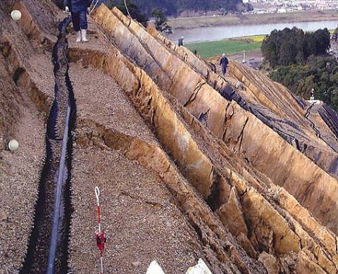
This photograph shows a toppling failure occurred on a cut slope with the
alternation of strata of mudstone-dominant sand-and-mud-stone in the Shimanto
Belt. The deformation of the cut slope occurred when the cut at a ridge-like
convex part reached to the planned plane. The cut slope is 44 meters high,
with a gradient of 1:10, and 130 meters long. Regarding its geometrical
relation to the geologic structure, it lays parallel to the strike, inclining
75 to 85 degrees to the strata of a system of fissures dipping backward.
The sandstone formation consists of a geologic stratum with 10 centimeters
thick, showing a discontinuous lenticular form, and the bedding planes
partially interlace one centimeter or less thick clay layers. Many drops
facing toward the mountain are found in the study area, and they are approximately
one meter high at maximum, occurring at the layered crushing.
(Photographed by Masashi UENO)