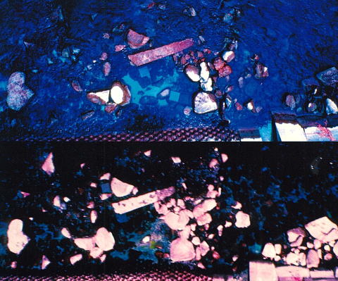
No.1
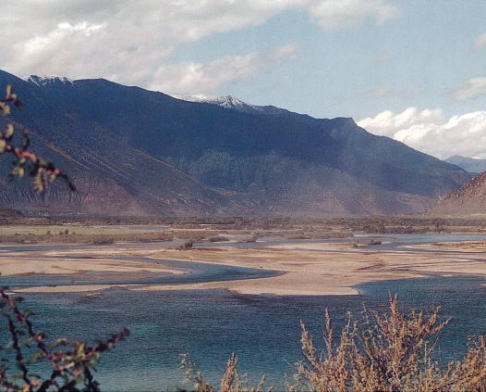
Yarlung Tsangpo, originated from the north face (ca. 80゜E, 30゜N) of the
central Himalaya Mountains, traces through the Tibet, from the west to
the east. Around the border between the Union of Myanmar and the Kingdom
of Bhutan, it changes the direction to south-west, be called as the Brahmaputra
Rivers, then merges with the Gangis River, and turns into the Bay of Bengal.
This river reaches about 3000 km. A cyclone in this region always causes
this river to flood the land of the People’s Republic of Bangladesh. This
picture was taken at the point 500km east from the Lhasa, on the way to
the then-unregistered Namchabarwa (7782 km). Sediments are composed of
the debris of gneiss from upstream, included a lot of muscovite and mica.
Reflected sunlight makes a fantastic view.
(Photographed by Shuusuke Kitahara)
No.2
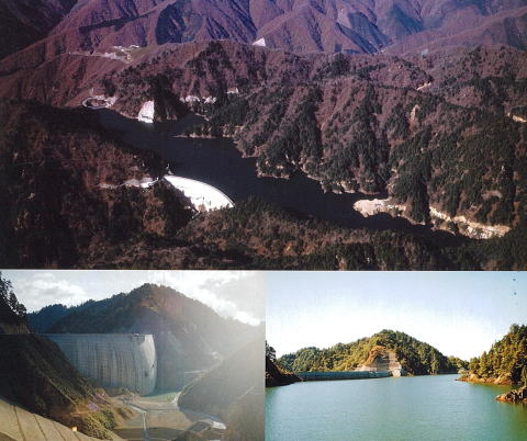
Kaore dam (107.5m in height) was constructed by Chubu Electric Power Company (Japan) as the upper regulating reservoir of the Okumino hydro power plant. It is a typical arch-gravity type dam recently built in Japan. It is in the V-shaped valley at the uppermost part of the Nishigabora-dani River of the Kiso-gawa river system, located in the Village of Itadori, Gifu prefecture, Japan. The geology of the dam site is Cretaceous Omodani rhyolites, and small-scale intrusions of porphyrite are found in some parts of the dam site. The upper picture is provided by courtesy of Hazama Corporation (Japan). The lower two pictures are provided by Isao SHIOZAKI : the left one was taken on October 19, 1993, in the early stage of the test impoundment ponding of the reservoir, and the right one shows the ponding condition on October 3, 1995.
No.3
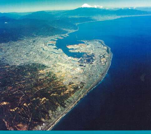
Miho Peninsula formed by coastal sand dunes
No.4
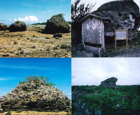
The limestone blocks on the Miyara Bay shore on the Ishigaki Island in
Okinawa Prefecture (left). The right end block in the upper left photograph
has 3-meter height, and about 5-meter diameter. Kato and Kimura (1983)
showed that these blocks are the tsunami stones drifted up by the Yaeyama
Earthquake Tsunami in 1771 from the result of dating of Favia speciosa
on the blocks.
(Photographed by Toshihumi Yoneshiro).
The limestone block called Okosukobizi(Obi-Ohiwa) on the coral reef terrace
of Simoji Island in Okinawa Prefecture (right). According to the ancient
writing, the block is also supposed to be derived from the Yaeyama earthquake
Tsunami,and to be named Obi-Ohiwa for the notch ,which is compared to being
belted (Obi means a belt in Japanese),carved in its middle part. It is
considered as the biggest existing tsunami stone in the world.
(Photographed by Tetsuo Amaya)
No.5
Near Infrared Color Images taken from a low altitude of 50 m using Kite
Balloon ;
The images were taken before and after discharging from Miharu Dam (Fukushima
Prefecture in Japan). The Near Infrared Color Image corresponds to the
false color image of satellite images, and the reddish color increases
in Near Infrared Color Image as rich in algae on the river bed, whereas
the reddish color decreases as poor in algae. These images show reddish
color decreasing with poor algae after the dam discharge.
(upper : before dam discharge, lower : after dam discharge; courtesy of OYO Corporation)
No.6
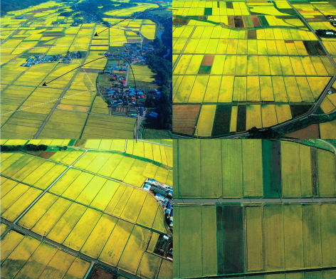
Ripe rice fields in a floodplain in Akita Prefecture