Malpasset Dam in France
After 5 years of the completion in 1954 of construction work in southeast
France, Malpasset Dam was destroyed in Dec. 1959. Over 400 people were
killed.The dam was an arch type concrete dam and was 61m high and 222m
long, 1.5m to 6.8m in breadth.Its bedrock is consisted of Hercynian metamorphic
rocks mainly of gneiss and schist.
The cause of the destruction of this dam was considered the existence of
the weak planes in the bedrock on the left bank. At that time, any detailed
geological investigation such as core drilling and trench investigation
had not been performed.
From this tragic accident, the geological condition of the bedrock and
the existence of weak planes such as faults has been recognized to be important
in the design stage of dam construction.
The dam site has been well preserved until now and investigations are possible.
We, IAEG Japan National Group members visited this dam site on 16 Sep.
in 2014, just 55 years after this tragic and important incident for engineering
geology in the world.
 |
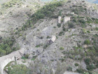 |
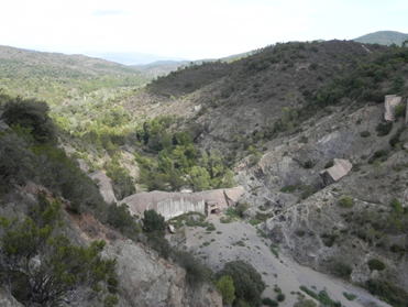
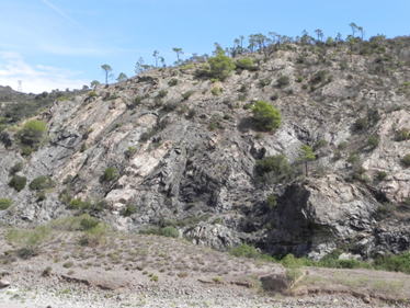
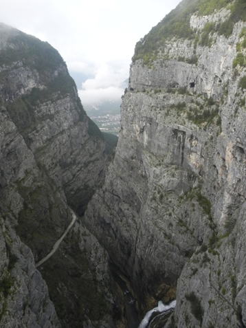
| View of the dam site from downstream of the right bank | Wedge shaped planes of bedrock in the left bank.Fallen large concrete blocks are seen |
 |
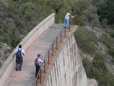 |
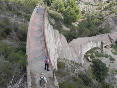
| Members investigating on the crest of remained dam on right bank(1) | Members investigating on the crest of remained dam on right bank(2) |
 |
 |
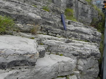
| Outcrops of gneiss in the downstream of the dam site. Hard rocks, but many complicated joints or foliation are seen |
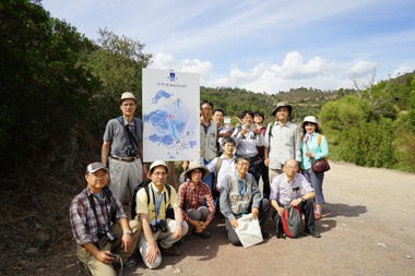
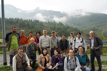
Investigation team members of IAEG Japan National Group |
 |
|
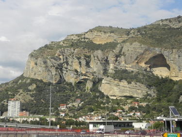
| Large wall outcrops of calcareous sedimentary rocks, near to Nice. Big eroded caves are seen |
Vaiont Dam in Italy
Vaiont Dam was constructed in 1960 in the north-east region of Italy, but
it’s reservoir was completely buried by the huge landslide of the slope
of Mt. Toc(1921m) in Oct. 1963. 2125 people were killed by terrible large
water wave that overflowed the dam. The volume of overflow water was estimated
about 25×106m3.
Vaiont dam is a concrete arch dam and is 264.2m high, 191m long and 3.4m
to 22.7m in breadth. The height of 264.2m is still the second one in the
world. Volume of the reservoir was 168×106m3. The bedrock of the dam site
is consisted of calcareous sedimentary rocks of Cretaceous to Jurassic
Formation. The landslide occurred on the slope of Mt. Toc that is composed
of Cretaceous calcareous sedimentary rocks dipping parallel with the slope
direction. Geological investigation had been performed during dam construction
mainly in 1959 to 1960 and the existence of the old (about 20 thousands
years ago) huge landslide which had buried old Vaiont canyon was reported.
Monitoring of landslide had been continued from 1959 after the start of
impounding the reservoir, however, the ruinous landslide of huge volume
occurred on 9 Oct. in 1963. The sliding mass was estimated to be 2.7×10⁸m3
in volume, 1500m long, 1800m in breadth and the maximum thickness was 250m.
After this terrible and tragic accident, the geological condition and stability
of reservoir slope were recognized to be important in design stage of dam
construction projects.
Vaiont Dam was completely abandoned, but was not destroyed by the landslide.
We can walk on dam crest now and can observe the shiny planes of the sliding
failure on the mountain slopes. The huge landslide mass burying the Vaiont
valley are seen from downstream and road.
We, IAEG Japan National Group members visited this dam and reservoir area
on 20 Sep. in 2014, just 50 years after this tragic and important incident
for engineering geology in the world.
 |
 |
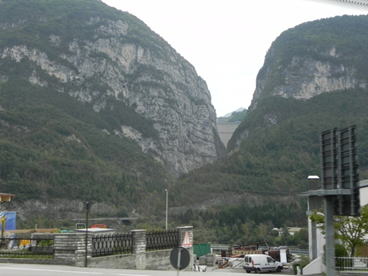
| View of Vaiont valley and dam from Longarone. 1190 people were killed by the incident |
Extremely steep slope of Vaiont canyon, view from dam crest |
 |
|
| Over view of failure plane of the landslide on the slope and movement mass (This photo is presented by Dr. Nakasuji) |
|
 |
 |
| View of the upstream portion of the landslide and movement mass | Landslide mass burying the reservoir. Structure of the sedimentary rocks are observed |
 |
 |
| Alternation of calcareous silt stone and limestone of Cretaceous to Jurassic formation at the dam site | Investigation team members of IAEG Japan National Group |
 |
|
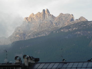
| Over view of mountains in the Dolomites area at Cortina d’Ampezzo |